
My journey saw me start in Turtuk, a small village set atop the glacial moraine at one end of the Nubra Valley. This had not been my original plan, but I had been unable to secure the right permits from the military to visit Op Baba as a tourist. Turtuk is the furthest point any tourist can go in the Nubra valley. Less than a kilometre to the west is a military base, another just four kilometres further and a third high up amongst the snow capped peak, all protecting the border from Pakistani invasion. Attempts have been made on more than one occasion, the last being in 1999. But it's understandable given that Turtuk itself was once part of Pakistan until India forcefully took control of it in 1971. Yet today Turtuk is a very peaceful, friendly place. Intricate irrigation systems divert water through fields filled with barley hand weeded by large groups of women all of whom raise their heads and say "Jullay", a word of welcome. Apricot trees in blossom dot the landscape, while both a Buddhist monastery and Muslim mosque maintain a local following. People of different religions live side by side and no one seems phased by the military presence.
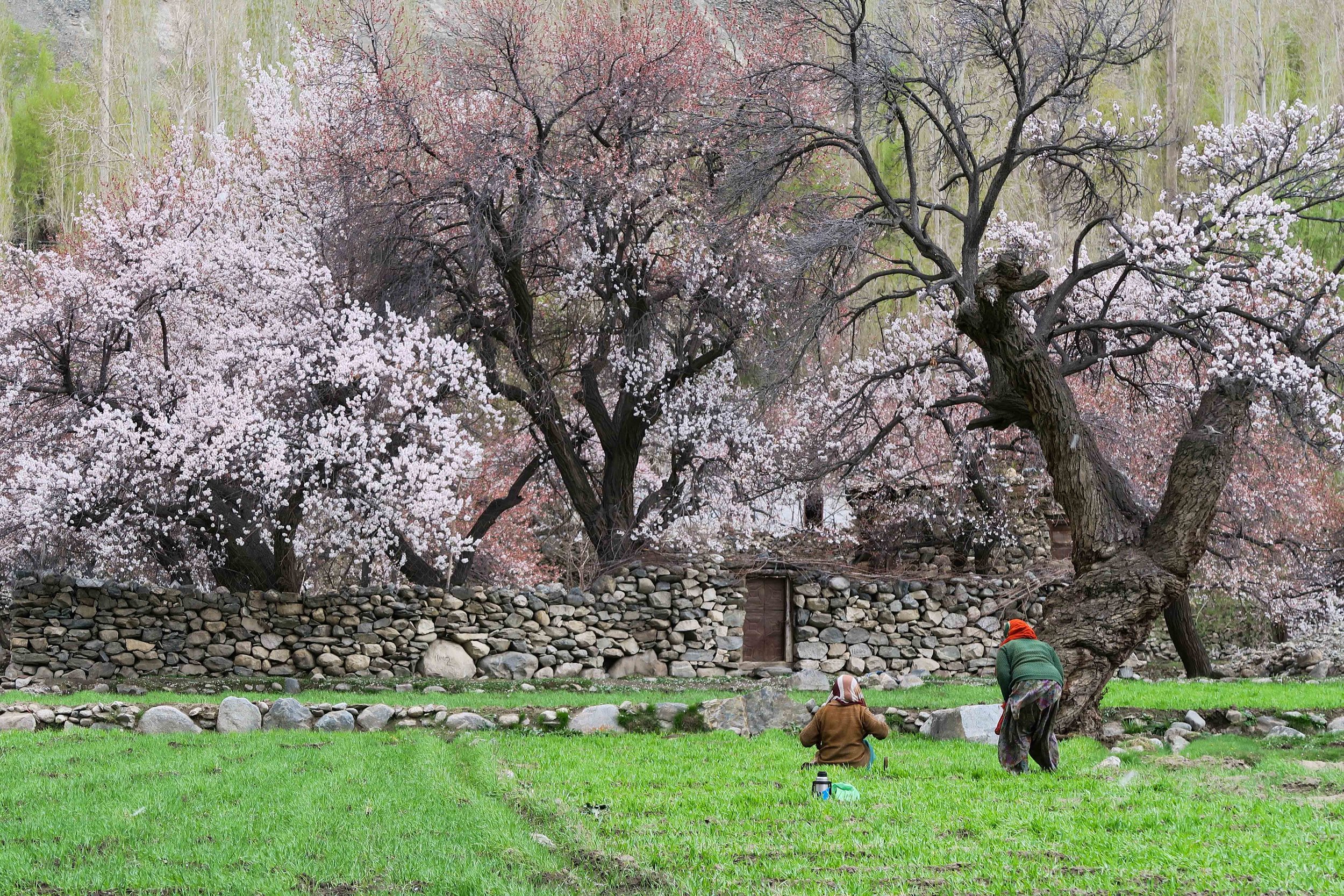
Apricot trees and barley fields in Turtuk
Namgyal, my guide and I set off early, the first of many days that will take me to Kanyakumari. As we walk, there is evidence of the military everywhere. Bunkers, metal bridges, a constant movement of trucks carrying military personnel to the various army bases littering the valley. Each look at us with a glare - why has a tourist come this far up the valley. I react in the same way to each - "Namaste", "Hello".

An old guy sitting outside a store
The local people remain friendly, offering us a seat in their restaurant, or a place to stay (we have yet to use the tent). They show no sign of reaction to military occupation. I suspect they are used to it, having lived side by side for so long. I ask one gentleman what it feels like to live alongside the army. His view is that they are a good thing. They build roads and schools, deliver food to the remoter parts of the valley and ensure the road remains open in the worst conditions. They make life easier for the people that live in the valley.
As we progress the landscape continues to impress. Huge glacial valleys dotted with boulders the size of a house at the bottom. A blue-green ribbon stream flows through the middle, meandering its way towards the direction we have come. Occasionally we see a path zigzagging its way up to a brightly coloured monastery covered with prayer flags. These prayer flags become common decoration for any household.

Prayer flags overlooking Leh
As we reach Diskit, we take the opportunity to visit the Diskit monastery, the jewel in the crown of the Nubra Valley. We arrive in time for the morning prayer, listening to the chanting and beat of the drum echo against the walls. Around us they are busy preparing for a visit from the Dalai Lama in July meaning the huge Buddha statue that overlooks the valley is having a spruce up, as well as new buildings being made and piles of wood for cooking being stored. It's incredible to see this level of organisation, but it's a very honorable moment for them, so they must impress.
As we near Khardung La, one of the highest motorable roads in the world, we try to take the short cuts to the road above us. We present our documentation at the check point only to be told it expires later that day and that we must reach South Pullu before dark. It's a further 30km, on top of the 19km we have already done that morning, adding to the 800m vertical we have already accomplished. After a quick lunch, we arrange to have our bags driven to Leh meaning we only need to carry the bare minimum. The tarmac turns to dirt, and as we climb higher it turns to ice.

Switchbacks in the road
Huge snowdrifts begin to envelop the road, while the temperature plummets. Walking becomes harder and harder and having not taken a proper break both Namgyal and I start to struggle under the conditions. I find myself unable to control my legs and I stumble on the ice, skidding around all over the place. After four hours of climbing, we reach the top. Jubilant, we celebrate next to a sign that tells us we have reached the top of the highest motorable road in the world. We can't stay long. It's 6pm and we must be on the move to get down the mountain to Leh before it gets too dark. And when we reach Leh, we can rest!

Reaching the top of Khardung La